The Himalayan Mountain range is one of the world’s most significant and formidable mountain belts, extending approximately 2,500 kilometers from the Brahmaputra River in the east to the Indus River in the west, with a width varying between 200 to 250 kilometers. This extensive range is crucial for understanding the formation and evolution of large mountain systems. The Himalayas impact local environments and regional weather patterns, affecting daily life for millions of people in the region. They define the border between the Indian subcontinent and the Tibetan Plateau and influence six nations: Nepal, China, Pakistan, Bhutan, India, and Afghanistan. Besides serving as a physical barrier, the Himalayas hold cultural and religious significance, with many peaks revered in Hinduism and Buddhism. Major rivers like the Indus, Ganges, and Brahmaputra originate from the Himalayas, supporting a population of approximately 600 million people across their drainage basin.
Formation
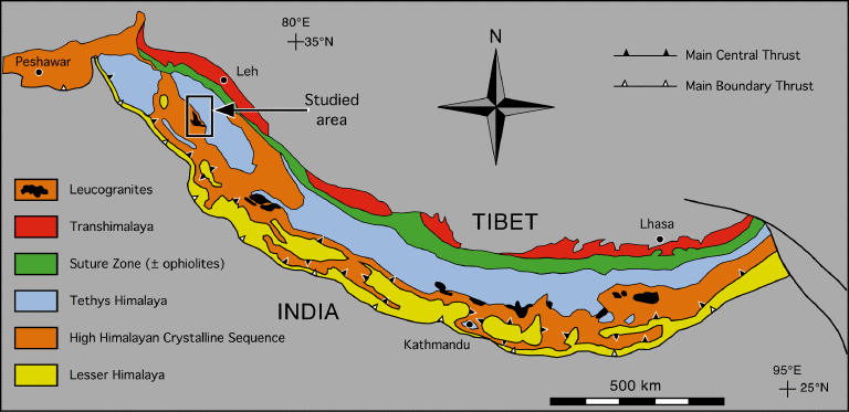
The formation of the Himalayas began around 250 million years ago during the era of the supercontinent Pangea, which was surrounded by the vast Panthalassa Ocean. As Pangea broke apart, it split into Laurasia in the north and Gondwanaland in the south, with the Tethys Sea lying between them. Sediments from these landmasses accumulated in the Tethys Sea, setting the stage for the Himalayan formation. About 130 million years ago, the Indo-Australian Plate started drifting northwards, gradually closing the Tethys Sea. By 50 million years ago, this plate had fully closed the sea and collided with the Eurasian Plate around 45 million years ago. This collision caused the crust to fold and thrust upward rather than subduct, resulting in the formation of the Himalayas. This process involved intense compression and uplift of sediments, creating the towering peaks. Isostatic adjustments, or the adjustments of the Earth’s crust caused by tectonic forces, continued over millions of years, leading to further uplift and the formation of major thrust faults. These include the Main Central Thrust (MCT) and Main Boundary Thrust (MBT), which delineate different geological zones within the Himalayas. The MCT separates the high-grade metamorphic rocks of the High Himalayas from the Lesser Himalayas, while the MBT divides the Lesser Himalayas from the Sub-Himalayas. By the Late Pliocene to Early Pleistocene, the Himalayas reached their current height. The ongoing northward push of the Indian Plate into Asia causes the Himalayas to rise about 5 millimeters annually, keeping the region geologically and seismically active. Marine fossils at Mount Everest’s summit highlight the region’s ancient origins beneath the Tethys Sea.
Division and geography
The Himalayas are divided into three main sections based on their latitudinal extent: the Trans-Himalayas, the Himalayan Mountain Ranges, and the Eastern Hills (Purvanchal). The Trans-Himalayas, located north of the Great Himalayan Range, stretch about 1,000 kilometers and include the Karakoram, Ladakh, and Zaskar ranges. This region features some of the world’s highest peaks, such as K2 in the Karakoram Range, and significant glaciers like Siachen. The Himalayan Mountain Ranges, also known as Himadri, extend over 2,400 kilometers from the Indus to the Brahmaputra. They are composed mainly of sedimentary and metamorphic rocks and are divided into three parts: the Greater Himalayas, with peaks like Mount Everest; the Middle Himalayas, which include ranges like Pir Panjal; and the Shiwalik Hills, the southernmost range known for fertile valleys like Doons and Duars. The Eastern Hills, or Purvanchal, consist of a series of low hills from Arunachal Pradesh to Mizoram, marking India's border with Myanmar, including ranges such as the Patkai Bum and Naga Hills. Additionally, the Himalayas are divided into four regional sections: the Punjab, Kumaon, Nepal, and Assam Himalayas. Each has distinct geographical features and elevations. The Punjab and Kumaon Himalayas are known for peaks like Nanda Devi, while the Nepal Himalayas contain some of the tallest peaks in the world, including Mount Everest. The Assam Himalayas are characterized by lower elevations and unique north-south mountain alignments.
Hydrology
During the Pliocene and Pleistocene epochs, the Himalayas experienced three major glacial cycles that significantly impacted regional and global climates. The uplift of the Himalayas initiated monsoons, leading to increased seasonal rainfall and more arid conditions, which intensified between 3.6 and 2.6 million years ago. This climatic change likely contributed to Northern Hemisphere glaciations by generating dust and strong winds that could lead to global cooling. Extensive glaciation in the early Quaternary created U-shaped valleys and moraines, with the maximum glacial advance around 63,000 years ago, followed by a retreat that formed numerous lakes. The glaciation was confined to higher latitudes due to moisture limitations, with the rising Himalayas obstructing moisture from the summer monsoon and contributing to reduced ice cover in mountainous regions during the Pleistocene. Recently, climate change has accelerated the shrinkage of Himalayan glaciers. The region currently contains about 100,000 square kilometers of ice, crucial for local water supply. Rising global temperatures and shifting wind patterns have exacerbated glacial retreat, with recent trends showing a 26% increase in glacial lake size over the past 40 years. Several rivers flow through the Himalayas, primarily draining into the Indus Basin and the Ganges-Brahmaputra Basin. Western rivers, including the Indus and its tributaries, flow into the Arabian Sea, while the Ganges and Brahmaputra rivers drain into the Bay of Bengal, forming the Sunderbans delta. Additionally, rivers like the Irrawaddy, Salween, Mekong, Yangtze, and Yellow Rivers, originating outside the Himalayas, are sometimes grouped as circum-Himalayan rivers. The region also features numerous lakes, with Pangong Tso, straddling the India-China border, being one of the largest. Significant lakes include Tilicho Lake in Nepal and Rara Lake in western Nepal. Some lakes, like Tsho Rolpa in Nepal, are at risk of outburst floods due to glacial melting. These lakes support migratory birds and contribute to local biodiversity, though many remain under-researched.
Climate and ecosystems
The climate and ecology of the Himalayas are shaped by a complex interplay of geographic and climatic factors, resulting in a diverse and dynamic environment. Spanning over eight degrees of latitude, the range transitions from temperate to subtropical climates. The mountains act as a barrier, preventing cold Central Asian air from reaching South Asia and allowing the tropical zone to extend unusually far north. For instance, warm air from the Bay of Bengal is channeled through the Brahmaputra Valley into southeastern Tibet, significantly influencing regional temperatures. In the Himalayas, temperatures decrease by about 2.0°C (3.6°F) per 300 meters (980 feet) of altitude, though local variations are pronounced due to irregular topography. Precipitation is heavily influenced by the Southwest Monsoon, which brings substantial rainfall to the southern slopes during summer. The monsoon's intensity varies from east to west, with heavier rains in the east. During winter, high-pressure systems over Central Asia direct dry air southward, resulting in dry conditions. The northern side of the range, or Tibetan Himalaya, experiences dry and cold conditions, particularly in the west, with sparse vegetation and primarily snowfall. Climate change is causing significant warming in the Himalayas, with temperatures rising by 0.1°C per decade from 1901 to 2014 and accelerating to 0.2°C per decade in recent years. This warming has led to more frequent warm days and nights, while cold days have become rarer. Glaciers are retreating rapidly, except in some areas like the Karakoram, with future projections indicating even higher temperatures and potential glacier losses. Increased precipitation is expected to impact river flows and hydropower resources. Ecologically, the Himalayas host diverse flora and fauna that vary with altitude and climatic conditions. From tropical forests at lower elevations to permanent snow and ice at the highest points, the region supports various species. High-altitude areas are inhabited by species like the snow leopard and Himalayan blue sheep, while lower elevations host primates such as the Gee’s golden langur. Climate change is causing shifts in species distributions, with some plants moving to higher elevations and changes in forest composition. The Eastern Himalayas are particularly noted for their rich biodiversity, having seen numerous new species discoveries in recent years.
Significance and resources
The Himalayas hold profound significance in various religious traditions. In Jainism, they are revered as the site where the first tirthankara, Rishabhanatha, attained moksha. In Hinduism, the mountains are personified as Himavat, the king of mountains, and are associated with deities like Parvati and Ganga. For Buddhists, the Himalayas are important pilgrimage sites, such as Paro Taktsang in Bhutan, which is linked to the origins of Buddhism. These sacred sites highlight the Himalayas' deep spiritual and cultural importance across multiple faiths. From a natural resource perspective, the Himalayas are rich in medicinal plants used for treating various ailments. Local communities depend on these plants for healing, contributing to both their well-being and the region's economic development. However, the forests face threats from illegal logging, which endangers this vital resource. Climatically, the Himalayas influence the weather patterns of the Indian subcontinent by interrupting monsoon winds, leading to significant rainfall and snowfall. They also act as a barrier against cold Siberian winds, moderating temperatures in India. Moreover, the Himalayas are the source of many major rivers crucial for northern India’s water supply. Their forests provide essential resources such as fuel wood and raw materials, and the rugged terrain offers opportunities for hydroelectric power generation. This combination of resources and natural features underscores the Himalayas’ crucial role in supporting both local communities and broader regional needs.
Concerns
Communities near the Himalayas are facing severe impacts from climate change, including unpredictable rainfall, flooding, rising temperatures, and landslides. These changes are particularly pronounced in Nepal, which is highly vulnerable to climate change, with over 1.9 million people at high risk and an additional 10 million at potential risk. In response, Nepal has developed Local Adaptation Plans of Action (LAPA) since 2011 to address these climatic hazards. The health impacts of climate change are significant, with rising temperatures exacerbating food scarcity, malnutrition, and the spread of diseases such as malaria and dengue fever. Increased waterborne illnesses and extreme weather events also threaten community health, particularly affecting marginalized groups like women and children. Notably, there was a major outbreak of dengue fever in 2022. Agriculture is similarly affected; rising temperatures are reducing wildlife habitats, leading predators like snow leopards to attack livestock, which causes economic losses for farmers. In response, some farmers have resorted to killing predators to protect their livelihoods, which exacerbates the conflict between conservation and agricultural needs.
Test your knowledge
The Himalayas act as a border between which two regions?